
One of our favorite parts about being in the enterprise mobility space is seeing all the unique ways people use technology to make their work more effective.
In the past, we’ve highlighted everything from the US Army’s new app to manage soldiers, to apps developed at the start of the COVID-19 pandemic to track cases and improve Telehealth access, to apps that help companies get new employees up to speed quickly. This week, when checking the latest news in the enterprise mobility space, we were excited to read about the rise of ArcGIS’s relatively new iPhone app, designed to help agents more efficiently gather and edit mapping data in real-time.
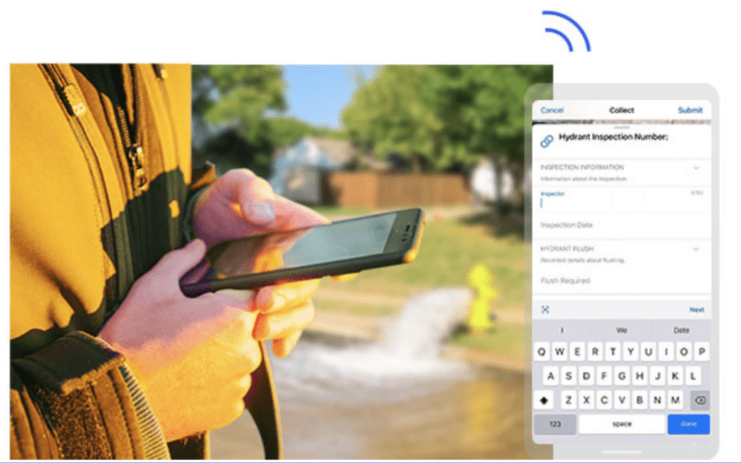
As Jonny Evans recently reported for Computerworld, the capabilities of the ArcGIS mobile app go far beyond paper-based asset tracking because the app “enables agents to gather and edit data and report it in real-time.”
As Computerworld reports, examples of Field Maps in action include Charlottesville’s fire department, which uses the app to maintain 1,500 fire hydrants across the city; food retailers which use Field Maps to figure out where to open up new stores; and a municipality in Colorado that uses ArcGIS’s app to manage the water supply.
The app, though, does more than just replace its paper GIS tracking counterpart. By leveraging the best of today’s mobile phone technology–like the LiDAR sensors in today’s top-of-the-line iPhones–the app goes above and beyond what was even possible in the space before. The Field Maps app isn’t just a mobile replacement–it’s an improvement. Overall, the app is a great example of innovation in the space and how mobile technology can improve processes rather than just sticking them on a phone.
To read more about how companies, municipalities, and others are using this exciting technology, head over to ersi’s ArcGIS page to read more about the app. And to speak more generally about how innovative mobile apps can help your business work more effectively, contact us today. We’d love to hear from you!
—
Photo credit: ArcGIS